DOI
Authors
License
Creative Commons Attribution 4.0 International
Publication date
April 5, 2022
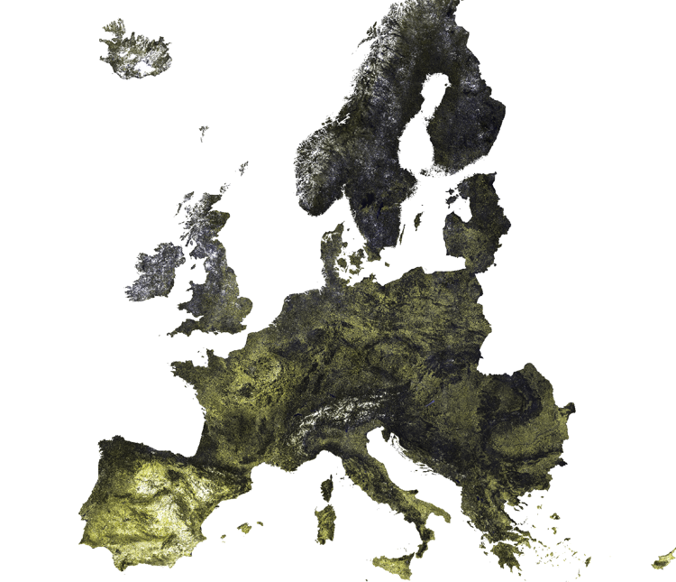
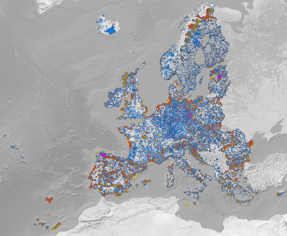
Twelve maps of continental Europe indicating the protected nature area status in 2019 according to Natura 2000 and the International Union for Conservation of Nature (IUCN). The IUCN status was extracted from crowdsourced data obtained from OpenStreetMap through geofabrik.de.
This dataset contains:
- 3 raster maps representing Natura 2000 protection status (A, B and C), named Natura2000_[status].tif
- 8 raster maps representing OSM-derived IUCN protection status (1a, 1b, 2, 3, 4, 5, 6, and 'other'), named OSM_IUCN_[status].tif
- 1 aggregated map (adm_protected.area_natura2000.osm_p_30m_0..0cm_2019..2021_eumap_epsg3035_v0.1) where each of the 11 protection statuses, as well as pixels where multiple statuses apply, are assigned a unique value.
Code on structure and applications of the dataset is available on GitLab
European coverage, 30m resolution, Cloud Optimized Geotiff, https download
EPSG:3035
Martijn Witjes, & Leandro Leal Parente. (2022). OpenStreetMap+ Protected nature areas in continental Europe (IUCN status + Natura 2000) (0.1) [Data set]. Zenodo. https://doi.org/10.5281/zenodo.6421437
The datasets can be accessed on Zenodo.
					#### The files are available as Cloud Optimized Geotiffs and can be accessed through our S3 cloud object service. can be accessed through  ####

library("rgdal")

GDALinfo("/vsicurl/https://s3.eu-central-1.wasabisys.com/eumap/adm/adm_protected.area_natura2000.osm_p_30m_0..0cm_2019..2021_eumap_epsg3035_v0.1.tif")

#Driver: GTiff/GeoTIFF
#Files: /vsicurl/https://s3.eu-central-1.wasabisys.com/eumap/adm/adm_protected.area_natura2000.osm_p_30m_0..0cm_2019..2021_eumap_epsg3035_v0.1.tif
#Size is 188000, 151000
#Coordinate System is:
#PROJCRS["ETRS89-extended / LAEA Europe",
#    BASEGEOGCRS["ETRS89",
#        DATUM["European Terrestrial Reference System 1989",
#            ELLIPSOID["GRS 1980",6378137,298.257222101,
#                LENGTHUNIT["metre",1]]],
#        PRIMEM["Greenwich",0,
#            ANGLEUNIT["degree",0.0174532925199433]],
#        ID["EPSG",4258]],
#    CONVERSION["Europe Equal Area 2001",
#        METHOD["Lambert Azimuthal Equal Area",
#            ID["EPSG",9820]],
#        PARAMETER["Latitude of natural origin",52,
#            ANGLEUNIT["degree",0.0174532925199433],
#            ID["EPSG",8801]],
#        PARAMETER["Longitude of natural origin",10,
#            ANGLEUNIT["degree",0.0174532925199433],
#            ID["EPSG",8802]],
#        PARAMETER["False easting",4321000,
#            LENGTHUNIT["metre",1],
#            ID["EPSG",8806]],
#        PARAMETER["False northing",3210000,
#            LENGTHUNIT["metre",1],
#            ID["EPSG",8807]]],
#    CS[Cartesian,2],
#        AXIS["northing (Y)",north,
#            ORDER[1],
#            LENGTHUNIT["metre",1]],
#        AXIS["easting (X)",east,
#            ORDER[2],
#            LENGTHUNIT["metre",1]],
#    USAGE[
#        SCOPE["unknown"],
#        AREA["Europe - LCC & LAEA"],
#        BBOX[24.6,-35.58,84.17,44.83]],
#    ID["EPSG",3035]]
#Data axis to CRS axis mapping: 2,1
#Origin = (900000.000000000000000,5460010.000000000000000)
#Pixel Size = (30.000000000000000,-30.000000000000000)
#Metadata:
#  AREA_OR_POINT=Area
#Image Structure Metadata:
#  COMPRESSION=DEFLATE
#  INTERLEAVE=BAND
#  LAYOUT=COG
#Corner Coordinates:
#Upper Left  (  900000.000, 5460010.000) ( 55d57'42.48"W, 56d18' 4.91"N)
#Lower Left  (  900000.000,  930010.000) ( 23d55'13.07"W, 24d32' 8.64"N)
#Upper Right ( 6540000.000, 5460010.000) ( 61d 5'51.71"E, 64d25' 1.96"N)
#Lower Right ( 6540000.000,  930010.000) ( 32d31' 8.79"E, 28d26'13.69"N)
#Center      ( 3720000.000, 3195010.000) (  1d18'47.59"E, 51d32'35.92"N)
#Band 1 Block=1024x1024 Type=Byte, ColorInterp=Gray
#  NoData Value=0
#  Overviews: 94000x75500, 47000x37750, 23500x18875, 11750x9438, 5875x4719, 2938x2360, 1469x1180, 735x590
Post Views: 1,277