OpenGeoHub together with partners Woodwell Climate Research and University of Florida, has released on the World Soil Day 5th of December 2021 the first ...
Read More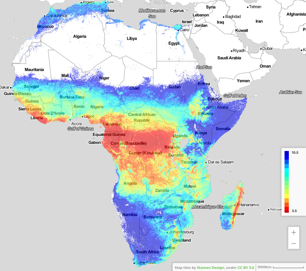
Importance of iSDAsoil More than 475 million out of 570 million farms in the world are smaller than 2 hectares. A substantial amount of them...
Read More