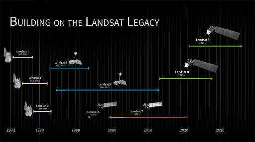
The NASA / USGS Landsat Program is the longest running initiative to provide space-based data for Earth’s land surface. Based on nine satellites, this...
Read More
Critical environmental information is today heavily under-used because it requires a high level of expertise and computing capacity. EO data is not yet a commodity and...
OpenGeoHub together with partners Woodwell Climate Research and University of Florida, has released on the World Soil Day 5th of December 2021 the first ...
Read More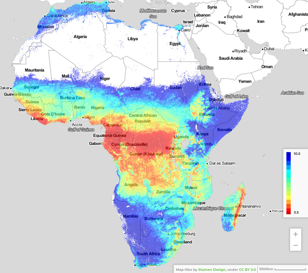
Importance of iSDAsoil More than 475 million out of 570 million farms in the world are smaller than 2 hectares. A substantial amount of them...
Read More
At OpenGeoHub and EnvirometriX, we recognize that machine learning, combined with AI, is a game-changer for both science and business. It’s having a major...
Read More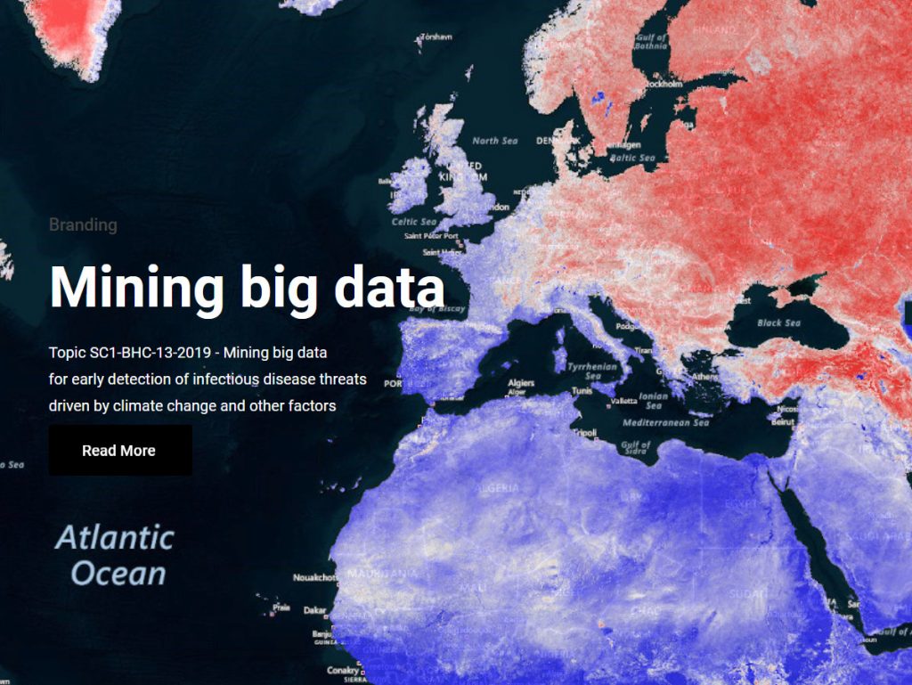
OpenGeoHub is proud to be part of the international consortium on the H2020 project MOnitoring Outbreak events for Disease surveillance in a data science context....
Read More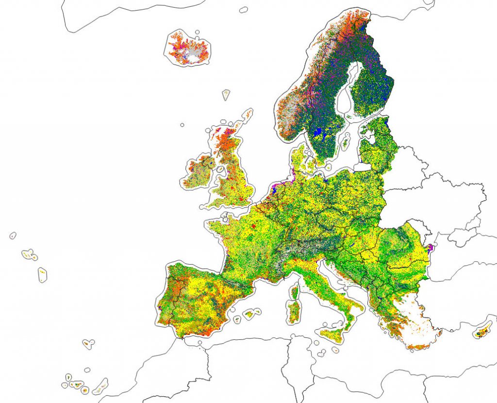
OpenGeoHub has started in 2019 an Innovation and Networks Executive Agency (INEA) co-funded project called “Geo-harmonizer: EU-wide automated mapping system for harmonization of Open Data based...
Read More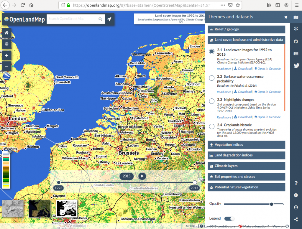
Making an OpenStreetMap-type data portal for land-related environmental data The OpenGeoHub Foundation is pleased to announce the first release of LandGIS, a new webmapping system...
Read More