Making an OpenStreetMap-type data portal for land-related environmental data
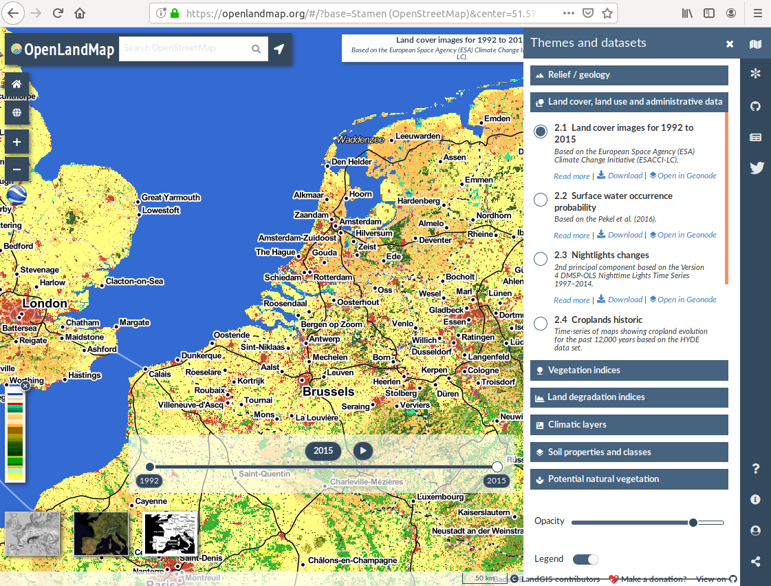
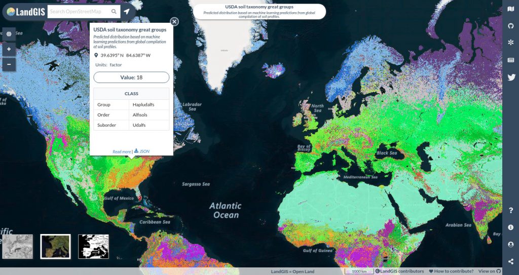
The OpenGeoHub Foundation is pleased to announce the first release of LandGIS, a new webmapping system that aspires to be recognized as the “OpenStreetMap for land-related environmental data”. LandGIS includes globally complete, fine spatial resolution (250 m to 1 km) datasets on relief, geology, land cover, land use, vegetation and land degradation indices, soil properties, soil classes and potential natural vegetation (see e.g. https://peerj.com/articles/5457/). These layers will continue to be updated through our open review process, and additional layers at 250 m spatial resolution and finer will be added in 2019. You can access the LandGIS app at https://openlandmap.org.
Making an OpenStreetMap-type data portal for land-related environmental data
The OpenGeoHub Foundation is pleased to announce the first release of LandGIS, a new webmapping system that aspires to be recognized as the “OpenStreetMap for land-related environmental data”. LandGIS includes globally complete, fine spatial resolution (250 m to 1 km) datasets on relief, geology, land cover, land use, vegetation and land degradation indices, soil properties, soil classes and potential natural vegetation (see e.g. https://peerj.com/articles/5457/). These layers will continue to be updated through our open review process, and additional layers at 250 m spatial resolution and finer will be added in 2019. You can access the LandGIS app at https://openlandmap.org.
Made 100% from Open Source software to serve Open Data
The LandGIS system has been developed using 100% Open Source software solutions Geoserver, Geonode, React, plumber R and OpenLayers, and supports rapid and intuitive visualization and review of spatial and spatiotemporal land information in 2D and 3D space. For example, users can visually review land cover change, historic land use, seasonality of climatic and vegetation indices, soil properties by depth intervals, soil carbon stock trends through time due to land cover changes and similar topics of environmental interest. The maps are made available using the most common OGC standards (WMS, WCS). Copies of the currently published maps are available for download directly from free and widely used data repositories, such as zenodo.org. All spatial data are currently provided at a spatial resolution of 250 m or coarser. Finer spatial resolution data (100 m+) may be offered in the future.
LandGIS is a system for Open Data; as the majority of the included layers are licensed under the Open Data Commons Open Database License (ODbL) and/or Creative Commons Attribution-ShareAlike 4.0 International license (CC BY-SA). As such, it follows closely the open data license policy of the OpenStreetMap Foundation. Read more about LandGIS here. To receive continuous updates about LandGIS, please register for the LandGIS discussion forum. The app is presently very much still under construction. If you discover an issue or a bug please help us solving it by reporting it.
How to contribute to LandGIS?
Help us continuously improve these maps by:
- submitting detailed corrections, comments and suggestions via https://github.com/Envirometrix/LandGISmaps/issues,
- contributing relevant training data such as field observations or laboratory analysis data for modelling soil, vegetation, parent material or similar subject areas (read more),
- helping this community project by joining one, or more, of the OpenGeoHub Working Groups,
If you are currently producing any similar types of data (e.g. environmental layers at resolutions from 100 m to 1 km for a global land mask) and if you would like to publish this data on LandGIS, please forward a proposal for publishing your global layers to the LandGIS development team.